GPS AND MAPREADING
The course learn the principles of GPS and Mapreading and is a module of Overlanding Skills Course.
The course consist of a 2-3 hour theoretical session which is done on an evening at our premises in Bellville. The practical course is a morning session done at Atlantis Dunes.
Price
R1500.00 per candidate included the permit.
Training Vouchers
We can issue training vouchers valid for 6 months as Birthday/Fathersday/Mothersday/Christmas gifts.
Vouchers will not be redeemable for cash or transferable.
What to bring with
(1). Your 4x4 vehicle with enough fuel.
(2). Protection against the weather. (hat, raincoat, sunglasses, gumboots, towel, sunscreen..)
(3). Preferable closed toe and heel shoes
(4). Own refreshments and 1.5liter drinking water.
(5). Vehicle's Owners Manual
(6). Air compressor and tyre pressure gauge
(7). Recovery equipment
(8). Certified copy of ID should you want a certificate. Please print your email address clearly on the copy.
You are welcome to bring along your spouse free of charge. It is fine to bring along one child provided that he/she will not cause any disruptions to the instructor or other candidates during the course. Parents will take full responsibility the environment is not kid friendly.

Press "Ctrl+F5" to refresh the page All links are opened in a new window

4x4 Offroad Academy
Professional 4x4 Training
Advanced 4x4 Recovery
Green Standards
Online Training
Advanced 4x4 Recovery
Green Standards
Online Training
Driver Requirement
The candidate must be familiar driving off-road
Attendance Certificate - Pdf format
We shall email you a certificate if you attend either the practical or theoretical session. A certified copy of ID is required should you require an attendance certificate of the training. Please print your email address clearly on the certified copy.
Training Manual
Each candidate who attended either the practical or theoretical session will receive the training manual in pdf format.
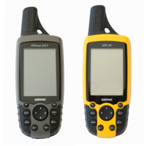
GPS & MAPREADING
MAPREADING ( Notations, Scale, Symbols, Datum, Contours, Vector vs Rastor, Orientation, Compass)
GPS & NAVIGATION ( Terminology, Position, Routes, Tracks, Backtrack, Vector/Rastor charts, Errors, Navigation)
